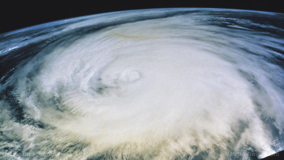
(Related: Have you checked out our report about weather modification and its consequences, both intended and unintended?)5:00pm EST radar image from @NWSKeyWest Doppler radar shows Hurricane #Rafael inland over western Cuba. #Havana is currently reporting gusts to hurricane force.
See the latest NHC advisory at https://t.co/tW4KeGe9uJ Visit https://t.co/qwaAHn9X6a for local information for the… pic.twitter.com/X56oURusUE — National Hurricane Center (@NHC_Atlantic) November 6, 2024
Will Hurricane Rafael's fury reach Helene-damaged Appalachia?
As of this writing, Rafael has maximum sustained winds of 115mph and is moving northwest at a speed of 14mph. Rafael, the 17th named storm this season, already passed by Jamaica, leaving behind little damage. Because of the situation in Cuba, the U.S. State Department is warning against travel there and offering departure flights to all non-essential staff so they can flee for safety from the island's affected provinces, which include Pinar del Rio, Artemisa, La Habana, Mayabeque, Matanzas, and the Isle of Youth." By the time it reaches the U.S. coast, Rafael is expected to weaken substantially. Current projections show the storm traveling west of Florida towards Louisiana or Texas. Some flooding is expected but it is unlikely that Rafael will bring with it the same degree of damage as Milton. "The good news is that while Rafael may well enter the Gulf as a hurricane mid-week, there is very little chance of the storm reaching land as a hurricane," commented Dr. Ryan Truchelut, WeatherTiger's chief meteorologist, to the News-Press paper out of Fort Myers, Fla. Disturbingly, there is also a chance that Rafael will still be strong enough at landfall to continue barreling north into southern Appalachia, which is still reeling from the after-effects of Hurricane Helene. Thankfully, the areas of Appalachia that were hardest-hit by Helene should stay mostly protected from Rafael based on current projections. As usual, the establishment is claiming that this rare early-November hurricane is the result of climate change. Sea surface temperatures throughout the Caribbean are still exceptionally warm, which increased the risk of Rafael forming by at least 60-fold. Right now, Rafael is the seventh Atlantic hurricane to undergo a rapid intensification process, which means the storm basically replaces itself to become even stronger, like a metamorphosis. "Some weakening is forecast while Rafael crosses western Cuba, but the storm is forecast to remain a hurricane over the southeastern Gulf of Mexico," the hurricane center reported after Rafael decreased to a Category 2 after making landfall in Artemisia, located just east of Playa Majana in western Cuba. By the end of the work week, Rafael will dump a substantial amount of rain on parts of the lower and middle Keys, but the path after that remains a mystery. Projections still seem to show a due-west travel path for Rafael into Texas, but things could change as the days progress. More related news can be found at Climate.news. Sources for this article include: Independent.co.uk NaturalNews.comSouthwest Airlines jet hit with GUNFIRE at Dallas Love Field Airport in bizarre shooting
By Ethan Huff // Share
Ukraine hopes to win Trump with its “victory plan” proposal
By Laura Harris // Share
By Richard Brown // Share
Chinese submarines can now track AND SINK U.S. Navy aircraft carriers
By Ethan Huff // Share
Peer review or advocacy? New study exposes undisclosed conflicts in climate science
By isabelle // Share
Gold, Silver, and the Coming Currency Wars: A wake-up call for financial sovereignty
By bellecarter // Share
Trump family's crypto empire: Billions in suspicious gains, zero accountability
By patricklewis // Share
Oil Prices Rise as U.S.-Iran Tensions Disrupt Strait of Hormuz Shipping
By sterlingashworth // Share
Trump Extends Iran Ceasefire; Selnick Cites Lack of Negotiating Partners
By garrisonvance // Share


