Unravel the mysteries of ancient maps and lost civilizations in Graham Hancock's "Fingerprints of the Gods"
- The 1513 Piri Reis Map, which was rediscovered in 1929, accurately depicts Antarctica's coastline – a continent officially discovered in 1818. This raises questions about the map's origins and the source of its information.
- Piri Reis claimed his map was based on older sources dating back to the fourth century B.C., suggesting an ancient civilization with advanced cartographic skills and knowledge of Antarctica's ice-free coastline, supported by recent geological evidence.
- Additional ancient maps, such as those by Oronteus Finaeus, Gerardus Mercator and Philippe Buache, also depict Antarctica with remarkable accuracy, challenging conventional historical narratives and suggesting a lost civilization with sophisticated knowledge of global geography.
- Theories, including those by Professor Charles Hapgood, propose that these maps point to a prehistoric civilization with advanced knowledge, aligning with myths of civilizing heroes like Viracocha and Quetzalcoatl, indicating a complex, interconnected past.
- Graham Hancock's "Fingerprints of the Gods" invites readers to re-examine and question established historical narratives, embracing the exploration.
Graham Hancock's "
Fingerprints of the Gods" is a groundbreaking exploration of humanity's forgotten past, challenging conventional historical narratives through the enigmatic Piri Reis Map and other ancient cartographic anomalies. The book takes readers on a journey from the archives of Constantinople to the icy wilderness of Antarctica, unraveling a story that suggests the existence of an advanced civilization predating known history.
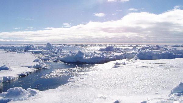
The Piri Reis Map, created in 1513 by Ottoman admiral Piri Reis, was rediscovered in 1929 in the archives of the Imperial Palace in Constantinople. This map painted on gazelle skin depicts the coastline of Antarctica — a continent officially discovered in 1818. Even more astonishing, the map appears to show Antarctica free of its massive ice sheet, which has concealed its true topography for thousands of years. This raises a profound question: How could a 16th-century map accurately depict a continent that was supposedly unknown and buried under ice for millions of years?
Piri Reis himself claimed that his map was a compilation of older sources, some dating back to the fourth century B.C. or earlier. This suggests that the knowledge of Antarctica's ice-free coastline may have originated from an ancient civilization with advanced cartographic skills. Recent geological research adds weight to this theory, indicating that parts of Antarctica may have been ice-free as recently as 6,000 years ago. This challenges the
conventional timeline of human history and opens the door to the possibility of a prehistoric civilization with sophisticated knowledge of global geography.
The Piri Reis Map is not an isolated anomaly. Other ancient maps – such as those by Oronteus Finaeus, Gerardus Mercator and Philippe Buache – also depict Antarctica with remarkable accuracy. The Finaeus map, for instance, shows Antarctica with ice-free coasts, mountains and rivers – suggesting the continent was visited or settled during a warmer period. Similarly, the Buache map depicts a waterway across Antarctica that aligns with modern seismic surveys, implying its source materials could date back to a time when the continent was entirely ice-free, around 13,000 BC.
These maps collectively point to a civilization that existed long before the rise of ancient cultures like Egypt and Mesopotamia. This aligns with the theories of Professor Charles Hapgood, who argued that the precision of these maps could only be explained by an advanced, pre-historic civilization. Hancock weaves these cartographic mysteries with myths and legends of civilizing heroes like Viracocha and Quetzalcoatl, suggesting a global pattern of lost knowledge and forgotten civilizations.
The implications of these discoveries are profound. If these maps are indeed remnants of a lost civilization, they challenge our understanding of human history and the origins of advanced knowledge. They suggest that humanity's past is far more complex and interconnected than previously thought, with a hidden chapter waiting to be uncovered.
While skeptics argue that these maps could be elaborate forgeries, the convergence of geological evidence, ancient myths and cartographic precision makes a compelling case for their authenticity. Hancock's work invites readers to question established narratives and remain open to the possibility that our history is richer and more mysterious than we have been led to believe.
"Fingerprints of the Gods" is more than a book; it is a call to re-examine the past and embrace the idea that humanity’s story is far from complete. As Hancock demonstrates,
the mysteries of the Piri Reis Map and its counterparts continue to beckon, urging us to explore the depths of our forgotten heritage.
Watch this video about
Graham Hancock's book "Fingerprints of the Gods."
This video is from the
BrightLearn channel on Brighteon.com.
Sources include:
Brighteon.ai
Brighteon.com